About RiaaS July 14, 2025
How Dareesoft’s AI-Powered Road Monitor is Transforming Road Maintenance and Urban Infrastructure
What is RiaaS Road Monitor?
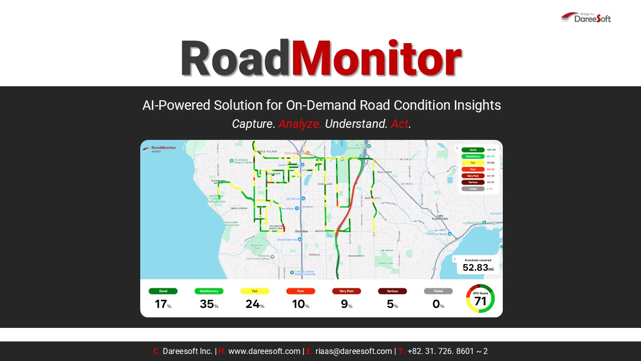
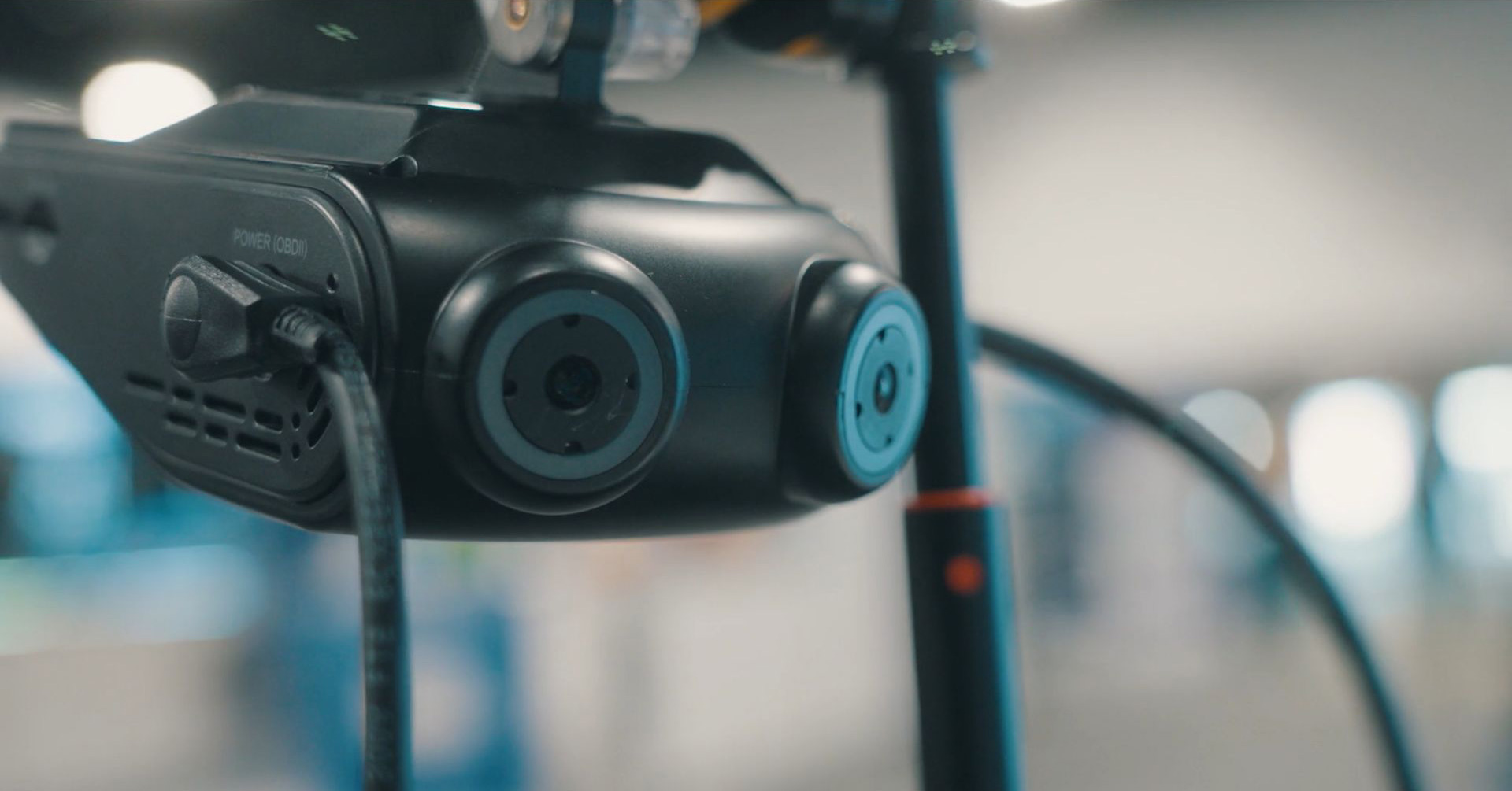
At its core, RiaaS (Road Information as a Service) Road Monitor is an on-demand platform that captures and analyzes road surface data using advanced AI models. It can generate 360° imagery of roadways using its advance 4 channel ARA 30 dash camera, provides continuous asphalt condition scoring through rPCI (rapid Pavement Condition Index), and maps out sidewalk status, crack details, and even roughness levels via the IRI (International Roughness Index). Additionally, it helps the stakeholders to understand which roads have been scanned and which remains to be monitored.
The system delivers a holistic, highly visual assessment of urban road networks—without the need for manual inspections or disruptive road closures.
Solving Real Problems in Road Maintenance
RiaaS Road Monitor tackles several pressing infrastructure pain points:
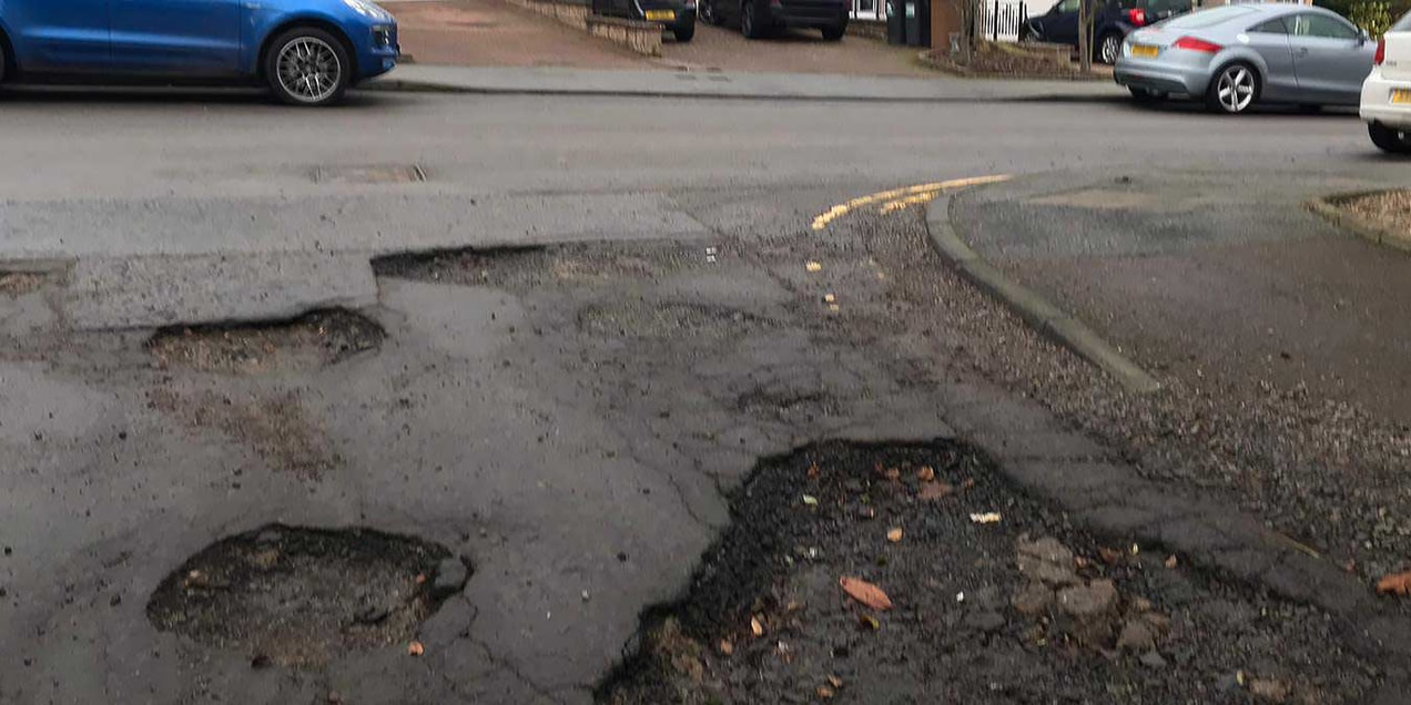
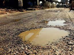
- Detection of unplanned hazards (like potholes and cracks)
- City-wide coverage tracking to ensure no street is left unmonitored
- Visual, data-rich maps that make road health easily understandable
- Efficient maintenance planning using AI-generated condition data
- Rapid Pavement Condition Index to make sure that the PCI data is backed with credible visual proofs
- IRI (International roughness index) provided by its cutting edge sensors and AI algorithms.
It bridges the gap between inspection and action, equipping city officials and contractors with the insights they need to prioritize repairs, manage budgets, and enhance public safety.
The Power of rPCI: Rapid Pavement Condition Index
One of the standout features is rPCI, an AI-based module that scores road pavement conditions on a 0–100 scale. The system uses color-coded segmentation—green for good to red for failed—to instantly identify problem areas.
This rapid, visual scoring system:
- Prioritizes urgent repairs
- Optimizes resource allocation
- Accelerates decision-making with clear metrics
Each road segment is evaluated and assigned a category, from “Good” (100–85) to “Failed” (10–0), creating actionable reports and prioritization lists for stakeholders.
This effectively rules out any possibility of corruption in the standard PCI reports which do not provide any visual proof.
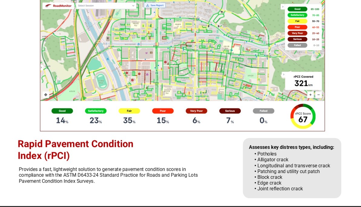 UI of r-PCI by Dareesoft (click on the image to zoom)
Smoothness Matters: Meet the IRI Measurement System
Another major innovation is the integration of the International Roughness Index (IRI), a global standard for measuring how smooth or bumpy a road feels to drivers. Dareesoft’s IRI system uses accelerometer data, AI processing, and a quarter-car simulation to deliver ultra-precise surface evaluations.
Benefits include:
- High accuracy without physical disruption
- Long-term monitoring for planning and budgeting
- Compliance with ASTM E1926 standards
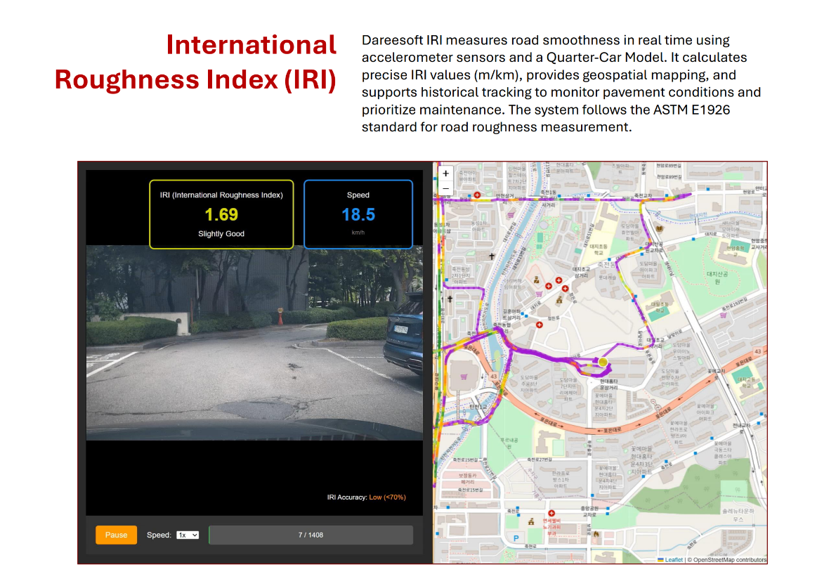 Visual data backed IRI for enhanced credibility (click on the image to zoom)
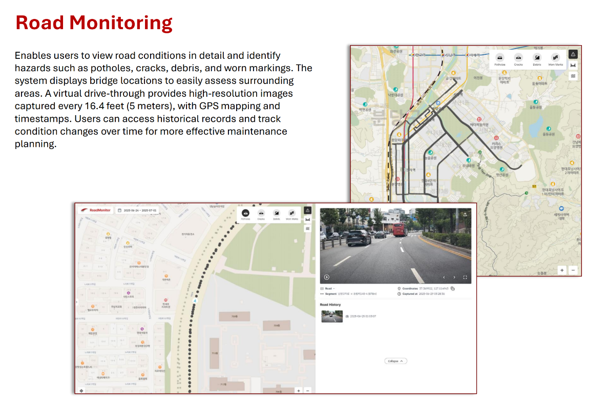
Street Imagery at fixed intervals- Complete digitalization of roads – detecting any unplanned Hazard
After providing advance AI based insights like IRI, rPCI and crack analysis, Road monitor also provides you with complete street imageries at fixed time or distance interval. This solution also displays street imagery in the form of video and displays the direction of movement in the maps providing a comprehensive insight into the situation of the roads.
What can come out of the street imagery?
- Finding unplanned hazards
- Finding emergency situations on the roads
- Crime detection
- Inspection of construction work
- Incentivizing or penalizing contractors based on the visual insights
This feature can have many use cases depending on the region and reason of deployment.
Complete City-Wide Road Coverage
The Road Monitor platform ensures full road network coverage, showing both inspected and uninspected areas on intuitive maps. By tracking GPS and ARA device status, municipalities can plan and execute maintenance strategies with total confidence.
 Street view imagery and coverage status (click on the image to zoom)
Who Benefits the Most?
This system is ideal for:
- Smart cities and urban planners
- Municipal road authorities
- Highway operators and contractors
- Public works departments
It not only improves road safety and durability, it also helps cities become more data-driven, sustainable, and responsive to infrastructure needs.
The features provided by Dareesoft’s Road Monitor are unique and currently no player in the world provides such a comprehensive one stop road maintenance solution. This makes Road Monitor more than a monitoring tool—it’s a complete intelligence layer for road infrastructure. With real-time visuals, AI-powered scoring, and predictive analytics, it empowers cities to manage their streets smarter, faster, and more efficiently than ever before.
Whether you're overseeing a dense urban network or planning highway upgrades, Road Monitor turns raw pavement data into actionable strategy—helping build safer roads and smarter cities.
POPULAR
-
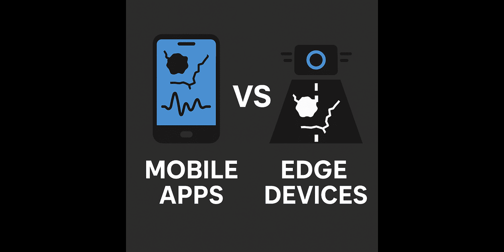 Why Most Mobile App Based Road Monitoring Companies Are a Joke
 -
 Convert Your Roads into Next Generation Roads with RiaaS
 -
 Are you a City Manager tired of finding Potholes? Try RiaaS, the AI powered technology which is disrupting the market?
 -
 𝗖𝗮𝗻 𝗗𝗮𝗿𝗲𝗲𝘀𝗼𝗳𝘁 S𝗼𝗹𝘃𝗲 𝗕𝗲𝗻𝗴𝗮𝗹𝘂𝗿𝘂'𝘀 "𝗣𝗼𝘁𝗵𝗼𝗹𝗲 𝗣𝗿𝗼𝗯𝗹𝗲𝗺" T𝗵𝗿𝗼𝘂𝗴𝗵 𝗔𝗜?